
Planning a Devils River Trip?
First off you will want to reference the Texas Parks and Wildlife web page for trip details, permits, maps, etc.. Permits & camp sites go quick so plan accordingly have back up dates with your group.

Dolan Falls near the Del Norte Unit on the Devils River
Groups of 4 seem to be the best as some of the campsites are tight.
There are only a couple of shuttle services I Utilize Amistad Expeditions for my Shuttle Service
- Amistad Expeditions -Outfitter and Shuttle Service http://www.amistadexpeditions.com; (830) 703-0127
- Expedition Outfitters Guided Fly Fishing Trips http://www.expedition-outfitters.net; (210)602-9284
- Reel Fly Guided Fly Fishing Trips, Shuttle Service, and Boat Rentals - http://www.reelfly.net; (830) 964-4823
- Gerald Baily does Bakers to blue sage or Bakers to Rough Canyon Marina trips. 830-395-2266
Your arrival to the area (pre trip/shuttle stay/lodging)
Rough Canyon Marina – camping only - (You can pre fish) – also a restaurant called hookers near by
Who Cares Bed & Breakfast -Marlene Walker
Address: 1683 Mier Ranch Rd, Del Rio, TX 78840
Phone:(830) 703-9210
Trip Options
There are 4 trip options
Bakers to SNA 4-5 days
Bakers to Blue sage 3-4 days (you miss the best parts of the river)
SNA to SNA – this is the most common option 3-4 days
Bakers to Rough Canyon Marina 5-7 days
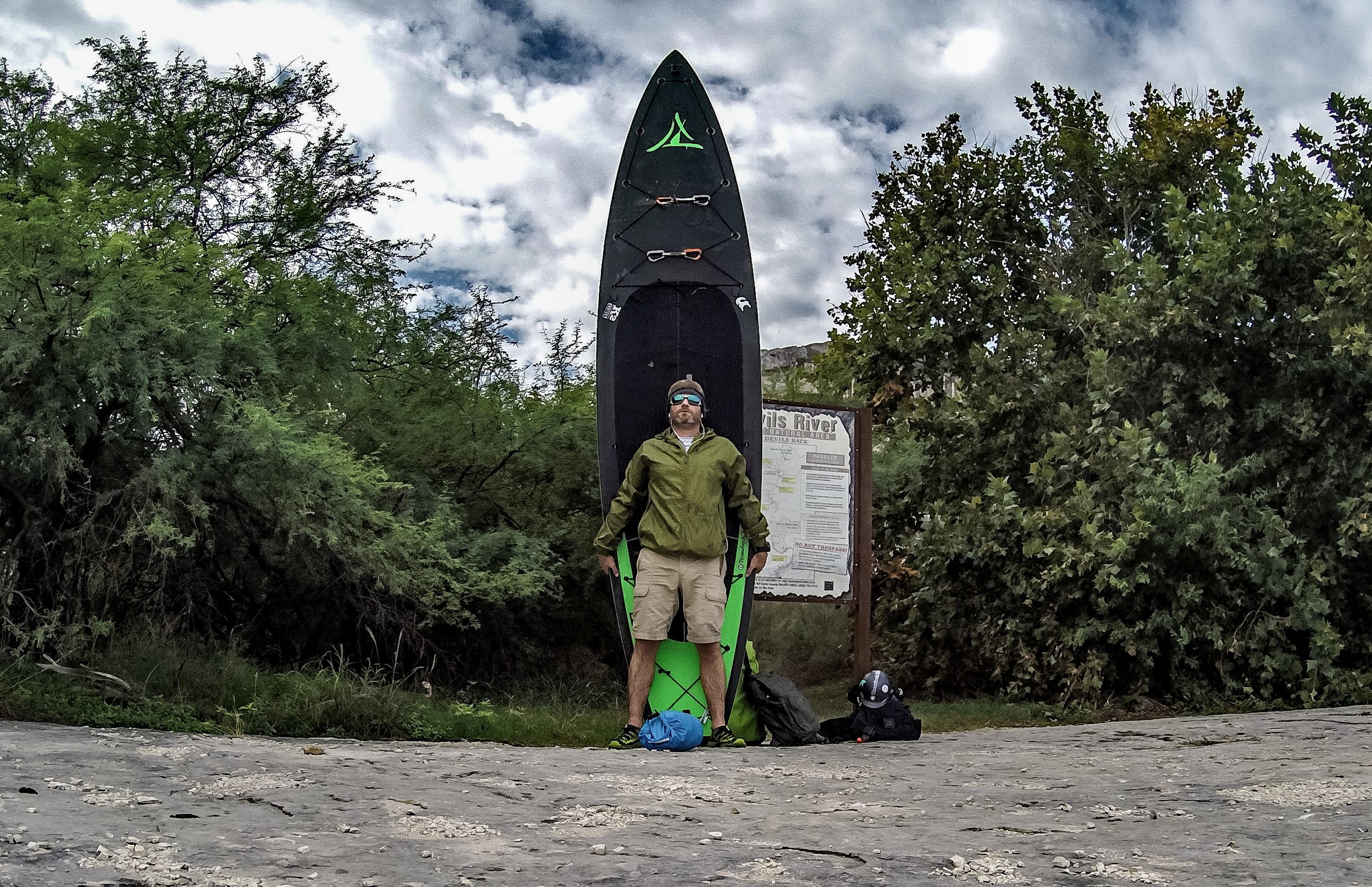
Daniel on his Solo Paddle Board Trip down the Devils River
Things to know
Have good quality Kayak – some lower end models I have seen come back with holes, cracks, etc… (bring Repair kit and back up paddle)
Utilize the permit process and the designated camp sites. The landowners will have police ready to issue you a ticket when you get out of the river if you trespass.
Leave no Trace practices – yes that means your poo too - WAG Bags are required
Gear List - TPW also has a general guide to needed items
The average paddler makes no more than 10 miles in a given day. On this river, more is easily done but fishing will take a back seat. There is development all along this river despite what people may tell you and not respecting property rights, trespass warnings, etc.. is disrespectful, wrong, and against the law (the landowners will prosecute). Though there are some legal gray areas when navigating and camping on Texas water ways, it is always better to camp on the inside of the river’s edge in the form of islands when camping outside of designated campsites. When in doubt, keep looking and don’t wait till dark to do so.
On your 1st day understand that you may not get to the river until 10 am or later pending your put in location so have a back up distance. When I paddle I will have 2 campsite locations planned for each day so just in case we get held up at a portage, kayak repair, exploring, or a heck of a fishing hole.
Start your trip with a minimum of 1 gallon of water per paddler and a at least 2 water filtration/purification systems. The water is good to filter right out of the river but there is a big nice spring at the North SNA near the paddlers camp that is great place to restock your stores if coming down from Bakers crossing. Walk up river on the jeep trail from the outhouse and you can’t miss it. Also, there is a cool little cave to explore. Otherwise, get your water from the river and filter/purify according to your device. If you are new to the whole drinking from the river thing, bring some flavoring, but keep in mind that some could have a dehydrating effect.
The river bottom is laced with razor sharp edges that will destroy shoes. Wear a solid pair of shoes to ensure your safety (it’s a long hard walk out of the river) I always carry a pair for the river and camp
You will need to check with local fire bans and know that fires are not permitted in SNA paddlers camps. If you do make a fire please utilize leave no trace practices.
Cotton is not recommended material, quick drying synthetics is highly recommended, you will be wet or get wet. also nights can get chilly so keep a warm pair in a dry bag just in case
Note: beginning in September this will be a catch and release only fishery, please checkback here for updated regulations and or the TPW website (link provided above)

Mike Filtering water through a gravity style filter
Minimum Safety Gear
PFD
Throw rope
Basic first Aid for the group
Spare paddle per 2 boats
Whistle
Survival Kit
Additional Safety Gear may be needed pending weather and Water levels check with TPW for a full list of required gear
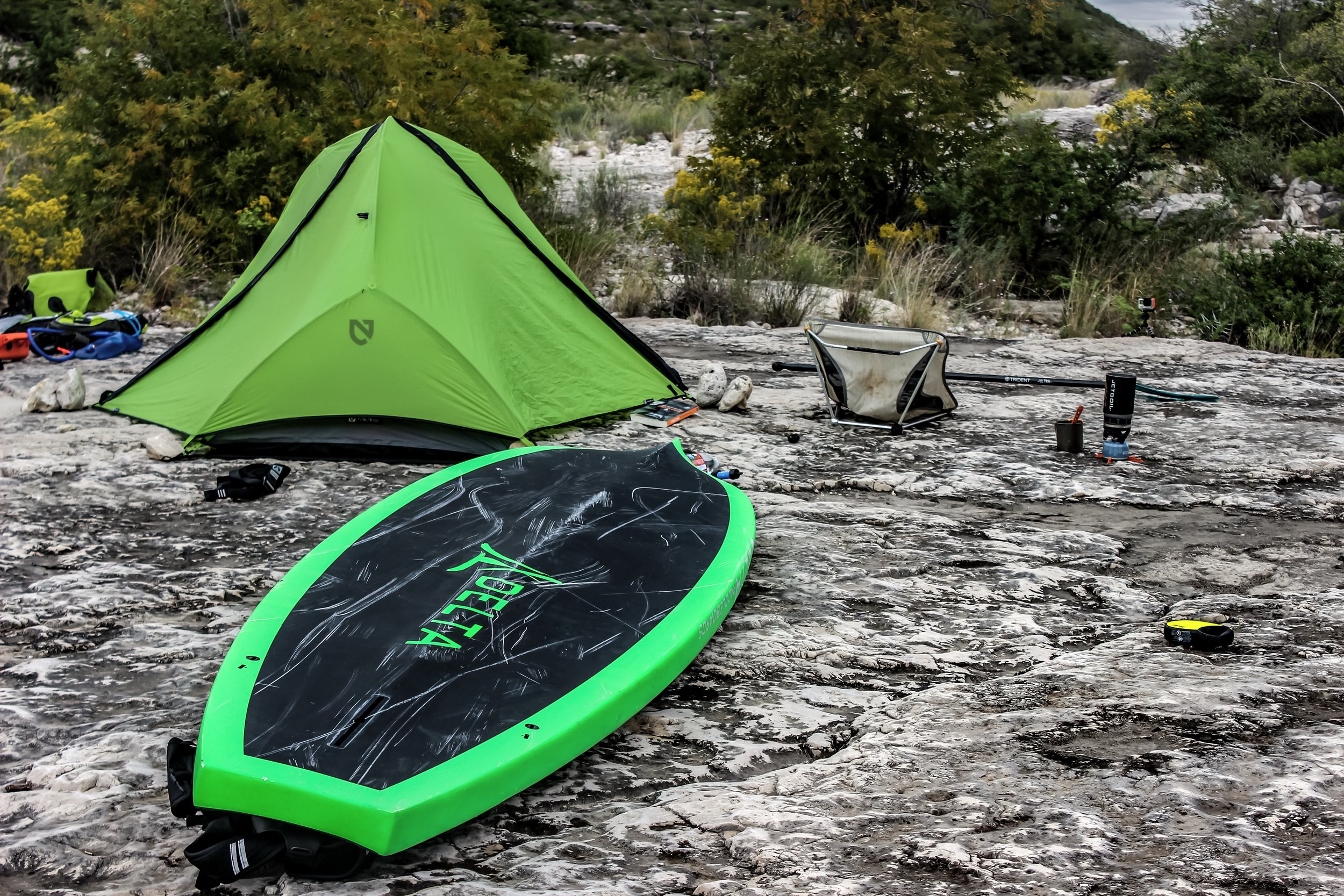
Normal camping locations
Camp 1 - New site aboveSNA (north)
Camp 2 – SNA (north)
Camp 3 – Past three tiers island left
Camp 4 – When the river narrows past second water crossingat Blue sage sub division the river will widen and start looking to your left for an island to camp. There will be some houses to your right on hill tops.
Camp 5 – SNA (south) at designated camp
Camp 6+ - Once in the lake area, it is public land camping at the lake’s edge is permitted in accordance with the Amistad national recreation area.

this map is provided to all permit holders
Hazards
- There are multiple rapids along the way ranging in Class I – IV pending water levels. Scout all rapids, it better safe than sorry. Portage if you have doubts. There are long cane like chutes that can potentially trap paddlers in strong currents.
- Dolan Falls -Do Not run unless you are equipped with the proper training and rescue equipment. Dolan falls has a strong hydraulic that can be deadly when done incorrectly. The risk of drowning and head impact is high on this falls. Do not run, rescue is hours away and can end what would be a great trip. Portaged river left, there is a multi-tiered shelf that makes for easy access down the falls.
- Three Tiers – Scout this prior to running. A chute begins the run with a Hard left hand 90 that drops into a series of small drops that can make for a serious injury and not to mention a nice big yard sale and lost and broken gear. Scout this rapid.
- There are multiple other hazards that are marked on the TPW provided map, please use caution on all rapids
- Weather - Know the forecast for your trip duration. If conditions are predicting rain in any portion of the drainage area (it is big) Flash Floods are possible with little to know warning, plan & know your egress rout prior to camping and have an alternative route as back up. Heat and cold are also major concerns, clothes and protections should be planned for prior to your trip.
- Cell service is rare and unpredictable. Carry a sat phone or spot type GPS tracker. It could save your life
For additional information contact us direct
Have a paddle plan left with a friend or family member. When in doubt, scout. Flash floods are a common place, be prepared. Follow the rules. leave no trace and Have Fun