

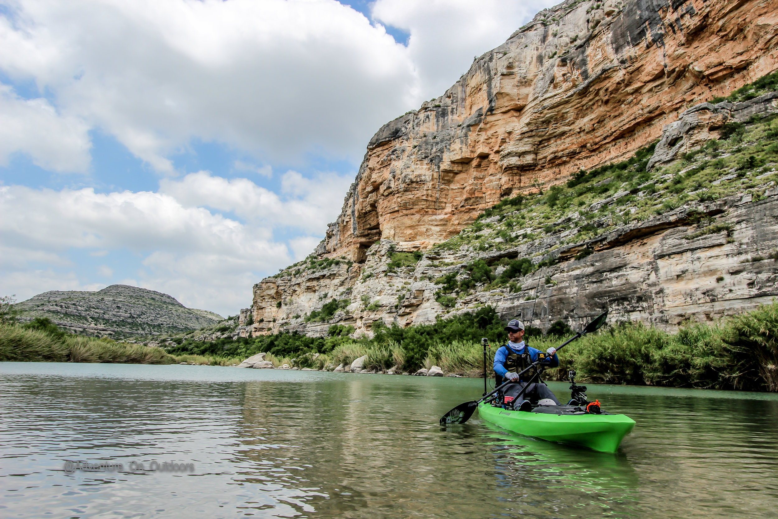
Robert Field on our most recent trip down the Pecos.
For starters this is not a trip for the faint of heart, it is physically demanding, hazardous and very unpredictable. Everything on this river wants to hurt you, cut you, poke you, bite you, and keep you at home. However, come prepared, know you limits, and be respectful, it will open its gates to a world you never knew existed.
Location: Pecos River
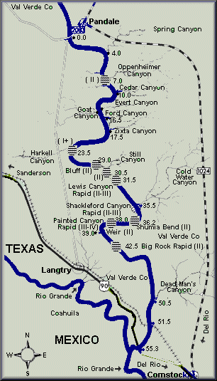
Put in: Pandale, Texas
Take Out: Old Hwy 90 - boat ramp - near Comstock, Texas
Distance: 61 river miles (class I - III+ (IV)
Duration: 5-7 days
Best times to go: Fall and Spring- summer months the heat is brutal and shade is limited, dehydration is a real threat.
Ideal River flow below is based on the Pandale Guage: (this river is boatable year round for recreational paddlers except for the extreme summer months)
ALL RAPIDS SHOULD BE SCOUTED PRIOR TO RUNNING - DO NOT ATTEMPT and portage IF THERE IS DOUBT - WEAR YOUR PFD - ALL WW SAFETY GEAR and knowledge in swift water rescue IS highly RECOMMENDED at all levels
under 100 - dragging and walking your kayak will be normal throughout your trip - water will be at its clearest - fishing tends to be better
100 - 200 - Some dragging bottom in the flute section - water is clear - fishing tends to slow as water levels increase- Rapids become strong and caution needs to be exercised more frequently
Over 200 - PROCEED WITH CAUTION OR RESCHEDULE this is considered minimum flow for Whitewater boaters - optimal is 300 - 1200 cfm many rapids can become dangerous for inexperienced WW paddlers. This river can get very dangerous for recreational paddlers and SOT kayaks not outfitted for whitewater runs at these levels
No permits are required
I do not recommend leaving any vehicles at the take out due to the remoteness and theft issues along the border region of Texas. You should use a shuttle service or have a secure location to park your transportation prior to coming into the area.
Arrival Day
You will need to schedule the following well in advance as there is limited resources in the area. Keep in mind the following:
What time you will arrive
Where are you going to stay prior to put in
When do you want to put in
When do you want to take out
Will you need a tow out (Ill get to this later)
It takes an hour to drive to the put in from the main shuttle location, so keep this in mind when scheduling with your shuttle service.
Places to stay
Comstock motel – this motel is near the shuttle and takeout - Also a great little place to eat and grab a beer across the street
Pandale Crossing Cabins – stay on river – note you will need the shuttle to drop you off here. it is a good hike to rivers edge and hard to carry all your gear and kayaks but is a great place to spend prior to your trip. It also allows you to get on the water quicker. Do not leave your gear unattended at rivers edge as this is a frequent stop for recreation day trippers
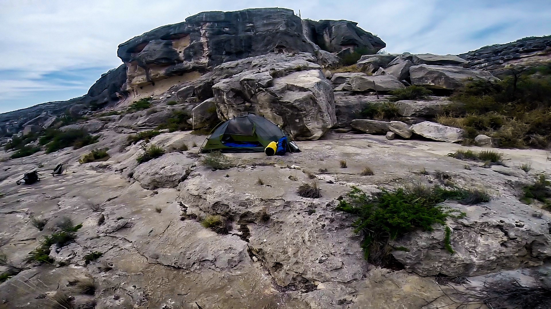
Camp at rivers edge - there is a large bedrock formation at Pandale on the river or about a mile down a large island if you want to save some money and time on your arrival day. You will need to plan this with your shuttle provider prior.
Del Rio is the closest major small town it has multiple hotels, places to eat, Wal-Mart, etc..
Lake Amistad area also has a few additional accommodations but you will want to stay of Hwy 90 for quicker access. These are also good places to stay after you get off the river
Shuttle Service
There are limited shuttle operators for this river, please keep this in mind when planning costs are not consistent and is charged by vehicle not person. If you have multiple vehicles you will need to assume 2 hours to shuttle each vehicle prior to getting your whole group together. If you use a trailer to transport you can cut cost for the group. The shuttle operates as follows.
Your vehicle will be the method of transportation to the put in
The shuttle operator will drive your vehicle back from the put in and store under a watchful eye while you are on the river.
The shuttle operator will drive you vehicle to the take out a few hours prior to your scheduled take out time.
Your vehicle will be left unsupervised during this duration. (You will need a spare key to access your vehicle at the take out)
The total cost is minimal so tips should be given to your driver
Shuttle Contact is Emilio - 830-317-0760
Things to know
Have good quality Kayak – some lower end models I have seen come back with holes, cracks, etc… (bring Repair kit and back up paddle)
Leave no Trace practices – yes that means your poo too
This is my full Gear List I do adjust this from time to time pending the trip duration and destination but its a great starting place to see where you stand
The average paddler makes no more than 10 miles in a given day. On this river, more can done but fishing will take a back seat. There is development all along this river despite what people may tell you and not respecting property rights, trespass warnings, etc.. is disrespectful, wrong, and against the law (the landowners will prosecute). Though there are some legal gray areas when navigating and camping on Texas water ways, it is always better to error on the inside of the river’s edge in the form of islands or on the waters edge. When in doubt keep looking and don’t wait till dark to do so.
On your 1st day understand that you may not get to the river until 10 am or later pending your prearranged meet up time with the shuttle so have a back up distance and camps planned. When I paddle I will have 2 campsite locations planned for each day so just in case we get held up at a portage, kayak repair, a cool place to explore, or one heck of a fishing hole.
Good shoes are a must - The lime stone base is eroded to form many razor sharp features that will tear up your feet.
Start your trip with a minimum of 2-3 gallons of water per paddler and a at least 2 water filtration/purification systems. The water is very alkaline and can have some adverse effects on persons. There are many springs but are very hard to locate. Water is the biggest issue paddling this river and drinking 100% out of the river is going to play a toll not only on your health but on your mental state as well. I do drink from the river for my duration but having several gallons of drinking water and cutting it with purified water from the river in 1:1 ratio will be a game changer on those very hot Texas Days. If your new to the whole drinking from the river thing bring some flavors but keep in mind that some could have a greater dehydrating effect. Click here for more info on the water situation and a hint to the springs.
You will need to check with local fire bans and know that Fires are not permitted in SNA paddlers camps. If you do make a fire please utilize leave no trace practices.
Cotton is not a recommended material for clothing, quick drying synthetics is highly recommended, you will be wet or get wet. Also nights can get chilly so keep a warm pair in a dry bag just in case
Leave a trip plan behind with your Shuttle and designated person back home
Camping on the river:

The land that lines this river is privately owned so you must keep Texas law by camping inside of the gradient boundary. Once you reach the lake it is covered under the national parks but those laws need to be upheld.
Camp fires are permitted as long as the area is not under a burn ban.
There are a real hazard to this area and flash floods are a common threat. You need to monitor forecast in large area to ensure safety. I do not recommend running this river if heavy rains are forecasted. Your life could be at risk
We have traditionally used the following camps:
ledge camp – you will see a large cliff on river left. The first section is the easiest access - Mile 10

Quartz camp – river left– small camp ground good for groups of 4-6 - river splits stay left - Mile 17
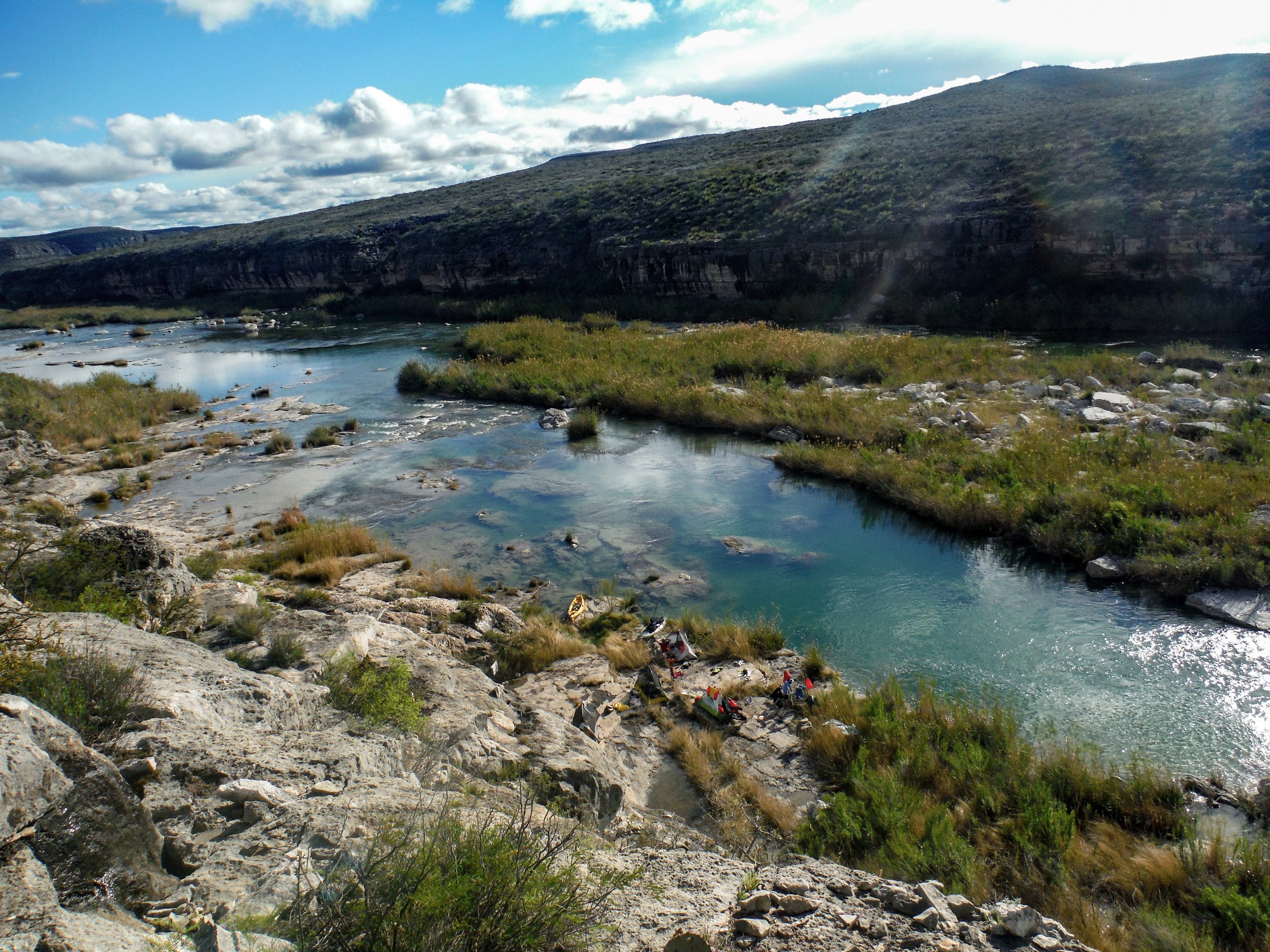
Overhang camp – this is the most dangerous camp and is at rivers edge with little escape from flash floods- in higher water levels this camp is typically flooded head south for about a mile and you will see alternate sites - Mile - 23

Lewis canyon camp – large ledge on river left many great spots along this stretch - Mile 31
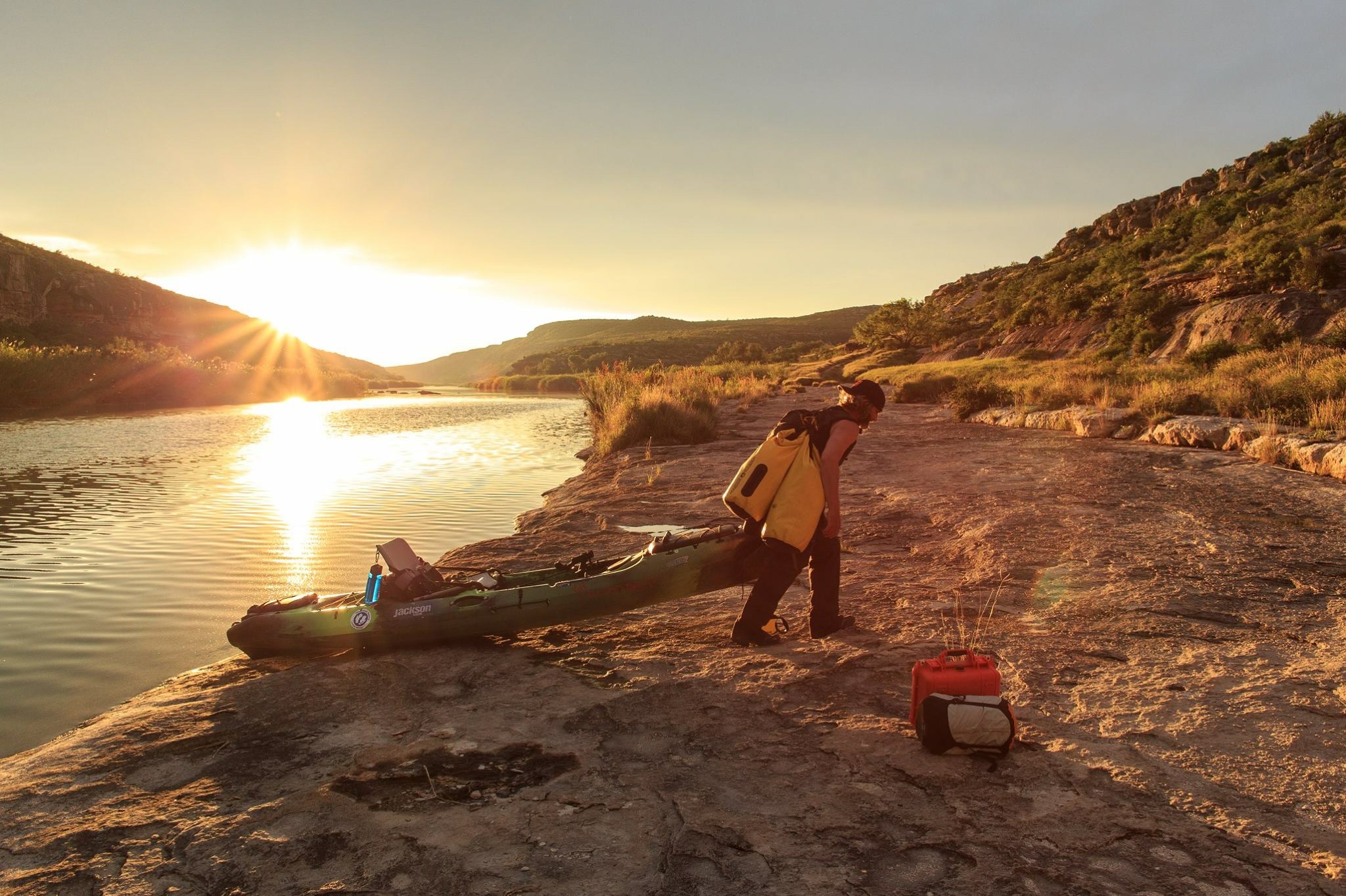
Photo by Daniel Rodriguez
Painted Canyon – river right before the painted canyon rapid - 39
Kayak Parking for the Painted Canyon camp
Camp below the big cliff that looks like a face carved in stone.
After painted canyon the next camp sites are past the weir dam. use caution in these area as the cliff walls are steep and provide little escape. once you reach the lake camp as needed. I like to do multi day camp sites to break up the days and extend my trips as I have time for.
There are alternate camps near mile 8 on river right, Evert Canyon Mile 12, Still Canyon Mile 29 and many, many more. Set daily mileage goals and be flexible as you group requires.
If you are using a tow out the boat will typically be between mile 45-50 pending water levels of the lake
River Levels & Hazards: (See above for optimal flows)
Have I mentioned Flash Floods? The Drainage area for the Pecos is very large and you need to take every precaution necessary for a safe return.
FLASH FLOODS ARE COMMON DURING THE YEAR – BE PREPARED AT ALL TIMES EVEN IF THE SKY IS BLUE
There is a guide book (link at end) that gives detailed information about the river that is priceless in everyway. It has sectional maps, sites to see, spring locations, etc. it is a catch all to this river but is dated in a few respects.
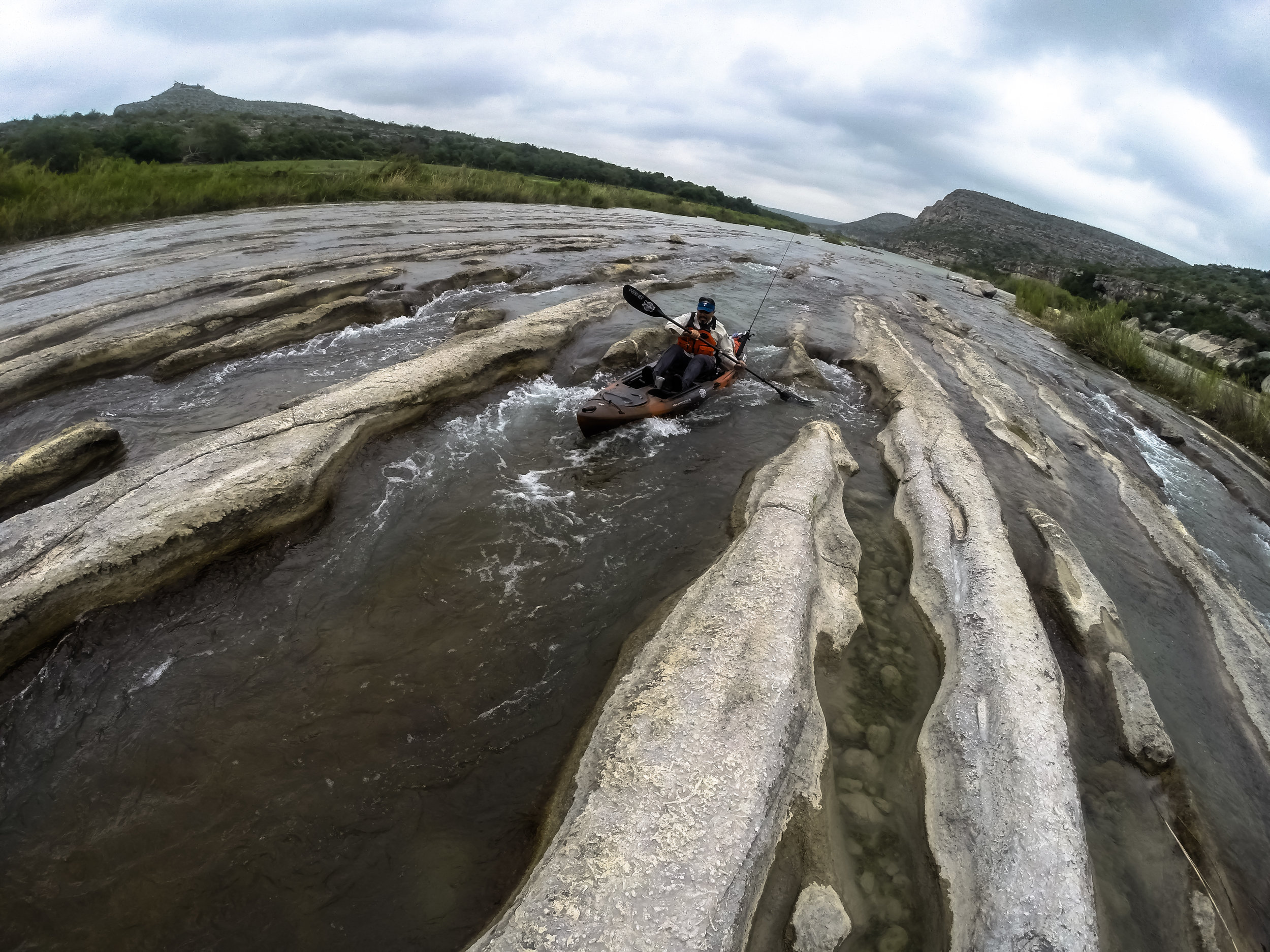
When the river is low you will be walking, there is a long section called the flutes where the river is very shallow and you could be walking and dragging your vessel for miles. If water levels are low you will not need any introduction to the area ,you will know you have arrived. Plan accordingly.
Remember you are at least a day away from any sort of help and that's only if you can get communication out. It is a multiple day hike out of the river through the roughest country Texas has to offer. A Satellite phone ore a GPS tracking devise is highly recommended. Cell service is non existent for the most part.
Rattlesnakes, copperheads, coral snakes, scorpions, Spiders, centipedes, killer bees, wasps, hornets and many other biting insects are a very common occurrence if you or anyone in your group is allergic to any bee or precautions need to be taken prior to coming to this area.
River Gauges
Pandale Gauge – This is where you will be putting in- This link will forecast if any Flood warnings or watches are in affect for the area. It will be shown as a dotted line once a watch or warning comes in. You need to be Contacted immediately if any Flood watches or warnings are in effect or any projection is being forecasted on this Gauge
http://water.weather.gov/ahps2/hydrograph.php?wfo=ewx&prob_type=stage&gage=pdat2
http://www.americanwhitewater.org/content/Gauge2/detail/id/33920/
Langtry Gauge – (downstream) this is at the weir damn prior to reaching the lake. I use this gauge as an indicator of total conditions on the river if a watch or warning is issued for it I want to know as it is a huge predictor of what is happening in the section I am paddling
Other Gauges to be noted
Sheffield gauge – Upriver Gauge from Pandale Use Above Link to navigate to it – Important Gauge
This gauge works off and on and needs to be monitored, as it’s a good indicator of what is going to happen at the Pandale Gauge.
http://water.weather.gov/ahps2/hydrograph.php?wfo=maf&gage=spct2&prob_type=stage
Independence Creek – This Is a major Drainage area for the Pecos if this is forecasted to Flood. We need to be notified of the extent of flooding or water rise. The gauge typically does not Work but if the area is in a flood warning or watch, we need to be contacted.
Girvan Gauge – This is quite a distance upstream from the put in site and will be an indicator of what the river will do downstream gauges
http://water.weather.gov/ahps2/hydrograph.php?wfo=maf&gage=givt2&prob_type=stage
MINIMUM SAFETY GEAR
PFD
Throw rope
Basic Multi-Day First Aid for the group
Spare paddle per 2 boats
Whistle
Survival Kit
Helmet and Additional Safety gear may be required pending water levels and trip duration.
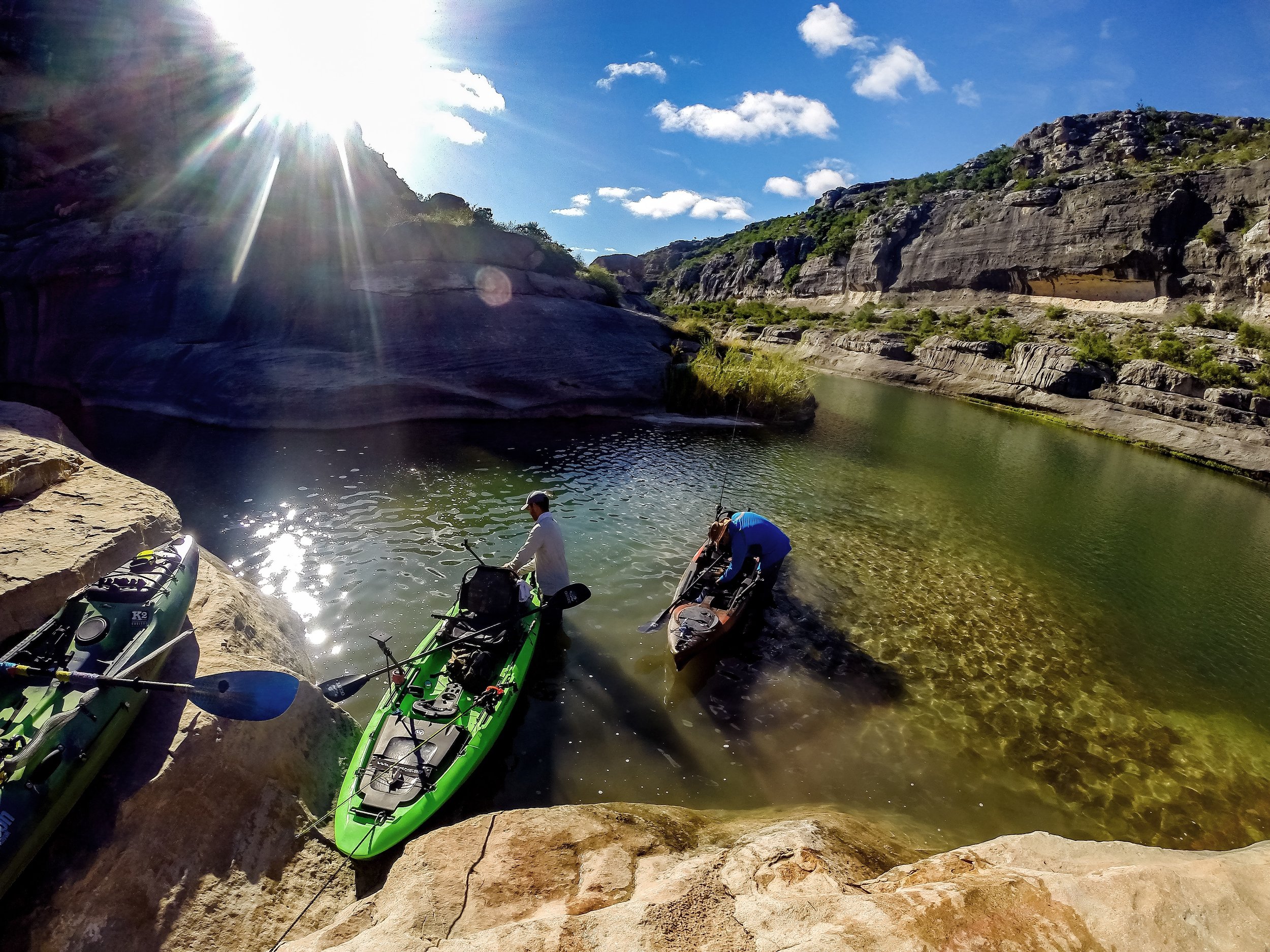
Rapids
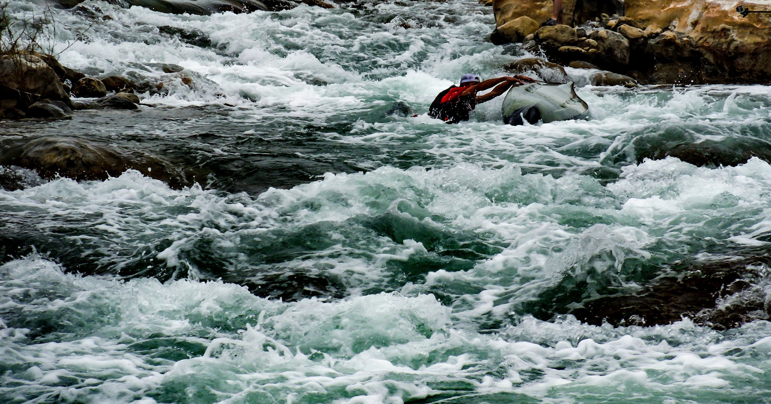
A bad entry flipped Luke on the Lewis Canyon Rapid at High Water Levels
The rapids along the river can change in different water levels and is always recommended to scout all rapids prior to running. the most notable rapids are as follows:
Oppenheimer Canyon Rapid - Mile 7.0 miles - solid Class II
Bluff Rapid - mile 29.0 - Solid Class II
Still Canyon Rapid - mile 30.5 - Class II
Lewis Canyon Rapid - mile 31.5Class III
Unnamed rapid - Mile 32.1 - Class III to III+ (this rapid can be very dangerous)
Shackleford Canyon Rapid - mile 35.0 - Class II-III
Painted Canyon Rapid - mile 38.0 - Class III-IV rapid - it is over 100 yards in length. It is a very tough and dangerous rapid that requires technical movements at high and low water levels. It is very common to have your kayak pinned, flipped, and lost.
Weir Dam - mile 39.0 - Class II drop - this should be portaged - strong hydraulic forms here
Big Rock Rapid - mile 42.5 - Class II drop, last main rapid before entering Lake Amistad
Life threatening injuries are a real threat on these rapids. Portage if in doubt.
Winds
The winds on this river can be very high and cause major delays and should be treated as a hazard. It is not uncommon for you to be unable to make forward progress by paddling even in moving water. On our trips, we have seen a kayak be blown a hundred yards into the river. We had a team member be flipped by winds. We have paddled the lake section where forward progress was limited to under 1 mph for hour.
The Lake
The lake section, pending water levels, is a 12 mile open flat water paddle with extremely high head and cross winds. Many persons traveling this section hire a Tow Out or plan additional day (1-2) to complete. Camping is available in many areas along the lake. The fishing is excellent.
Additional Resources
We are more than happy to help you with a trip plan that is tailored to you and your group. There are alternative trips to visit this river and we will be happy to assist you in planning.
If you need help planning a successful trip please message on Facebook or drop us an email
Southwest paddler and Texas Parks and Wildlife